Adventures in Mapping (Part 2)
(This is continuation of my mapping series. The first article can be found here...)
After reaching out to the Blair County Conservation District, I was given permission to build a map at their NatureWorks Park in Hollidaysburg, PA. This park, currently under construction, is scheduled to open in August of 2018.
Using DroneDeploy, I again identified the area to map and my son and I prepared to visit the site on Friday, May 25th.
Improvised Launch Pad
Once on site, we ran the Phantom 3 Standard through a normal pre-flight check list using the provided DJI Go application just to make sure everything looked OK. I then fired up the DroneDeploy application and started the mission. This is where technical difficulties started...
Generally, the application launches the drone and then shows a map of the area along with the UAV's expected flight path shown as a solid line imposed over the map. However, for some reason, only about 25% of the lines were solid, the rest were dashed when I started the mission. I wasn't sure what that meant, so I just let the drone continue on its way. It flew the solid lines, but then stopped, returned home, and then landed. The application seemed to indicate that the mission was complete and that the next step was to upload the photos...
Barn at NatureWorks Park
There wasn't much we could do at this point, so we headed home. Once there, I confirmed that the captured photo set was incomplete. I ended up deleting that DroneDeploy mission and creating a new one. We headed back out (fortunately, this park isn't too far from our home base) for round two.
This next flight was showing promise... We did the test flight, launched the drone, and it seemed to be acting appropriately. But then it just stopped. I still don't know why, but after completing about 75% of the flight, the drone made a corner and just hovered. There was no message or any type of error indicator on the application. My theory as to what happened is that my remote control's battery had drained to to exactly 25% at this point, and I believe that when I'm flying with the normal application, there is an warning message about the low battery condition displayed to the pilot. Perhaps that error condition had been reached and the DroneDeploy application did not know how to handle it, so it just stopped. Sigh... The map would have to wait for another day. We again headed home.
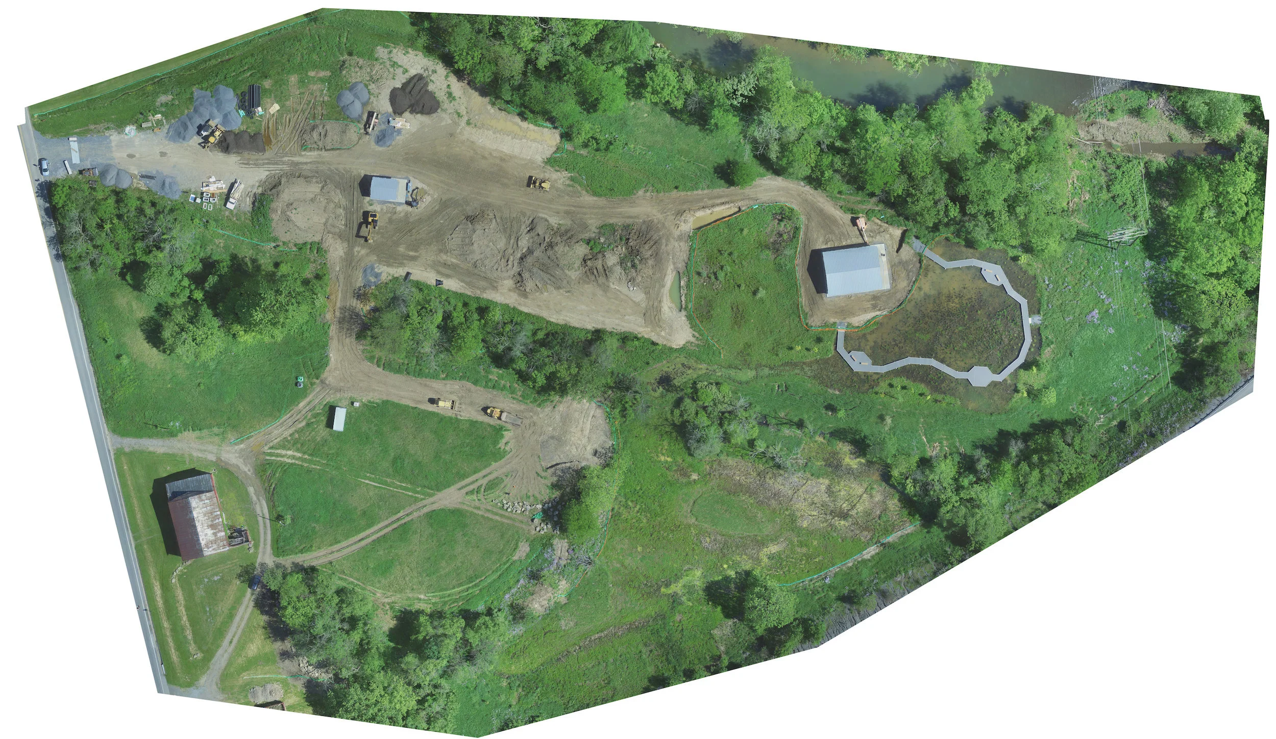
Overnight, we recharged all of our batteries (including the controller) and headed out again on Saturday morning. The flight was successful and we managed to map all 10.8 acres of the park at 1.4 cm/px. The flight lasted about 22 minutes and nearly exhausted the UAV's battery. This time, DroneDeploy worked like a charm and we had no issues with the workflow. We uploaded about 200 photos in slightly over an hour and then waited another three hours before the maps were processed and made available.
The maps on the DroneDeploy site are again very impressive. I really like that you can see the progress being made at the site by turning on/off the 2D map and comparing it with the Google Maps base map imagery. I could certainly see how these maps would be useful to track progress at a construction site as well as measuring volume and distance.
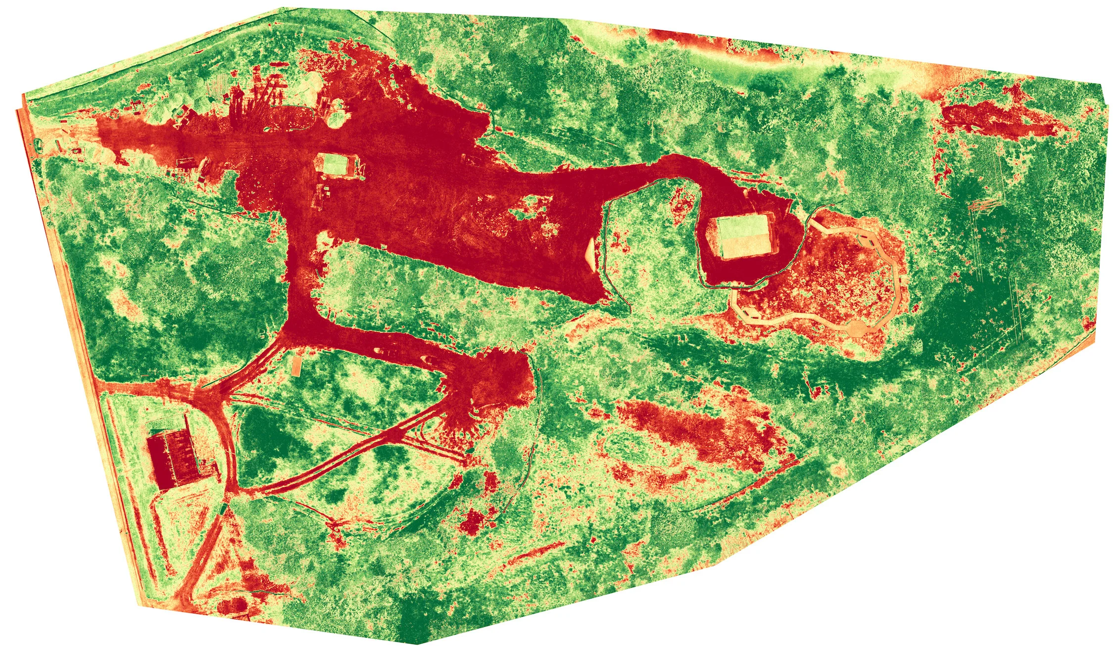
Below are the three main maps:
- An orthomosaic (the stitched together aerial photographs)
- A plant health map
- An elevation map
Of course, the interactive 3D model was also created and is viewable on the DroneDeploy site.
I continue to be impressed with the mapping capabilities of DroneDeploy. My free trial ends at the beginning of June and I'm curious to see what happens to the maps that I've already created.
While I was at the NatureWorks work site, I grabbed a few aerial photos of the park, and my family is looking forward to visiting once construction is complete!


